
| EARLY HAND DRAWN BRENHAM FIELDS KANSAS METEORITE DEBRIES FIELD MAP WITH SPECIMEN | |
| |
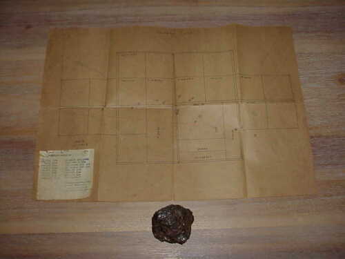
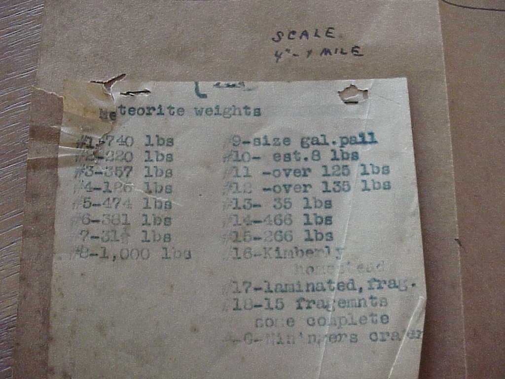
 Description: I believe this map is circa 1920's-1930's. It does have a couple of tears on the sides but still will display well. Brenhan m. .37'36' N., 99'12' W. Kiowa County, Kansas, U.S.A. Found 1882 Stony-iron.
Winning Bid: USD $360 - 12 bids (Year Sold: 2020 ) |
Found near: Kansas, United States
Approx/Nearest City GPS Coordinates (Lat, Long): (, )

No comments have been left yet